Dutch Mountain Trail - 101 km
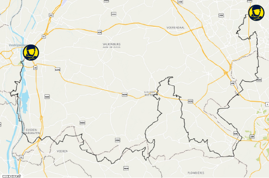
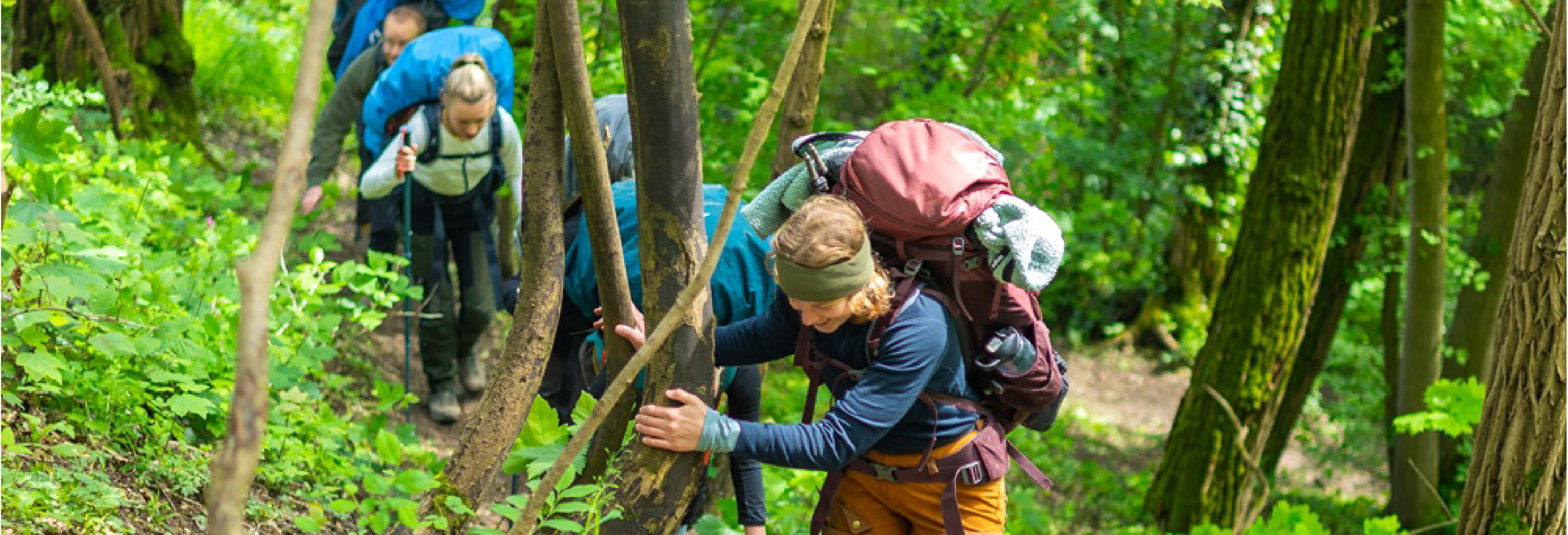
The Dutch Mountain Trail was developed in 2020 and has since gained popularity. Rightfully so: it's considered the most challenging of all Dutch trails. The route winds through beautiful landscapes and connects the Seven Hills in South Limburg, offering the most elevation gain of any trail in the country. In 4 stages, you'll pass wild streams, meadows, and rocky sections. With a bit of imagination, it feels like hiking in the Alps — which is why it’s called the Dutch Mountain Trail. The relatively long stages also make it a demanding hike. You can either camp along the way or book one of the many accommodations.
There are no trail signs, so it’s advised to use the Dutch Mountain Trail booklet or the downloadable GPX file for navigation.
Length: 101 km
Days: 4
Start: Eygelshoven Station (Kerkrade)
End: Maastricht Centraal Station
Tip: Planning to camp along the trail? Check out our lightweight camping gear checklist!
Krijtlandpad - 93 km
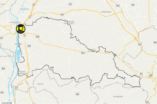
This 6-day hike in the south of Limburg winds through lush green valleys and vineyards. The Krijtlandpad is an alternative to the Dutch Mountain Trail, with fewer elevation changes and shorter daily stages. The hilly landscape of South Limburg still presents a challenge, so don’t expect a flat walk!
The Krijtlandpad is a circular route starting and ending at Maastricht Central Station. Along the way, you’ll pass rolling hills, country roads, and picturesque villages, with plenty of opportunities to enjoy coffee and cake on a sunny terrace. It’s a beautiful hike in every season, with various accommodations along the trail.
Length: 93 km
Days: 6
Start/End: Maastricht Central Station
Tip: 6 days of hiking requires some training and the right gear! Read more about the importance of hiking socks before setting off.
Heuvelrughike - 92 km
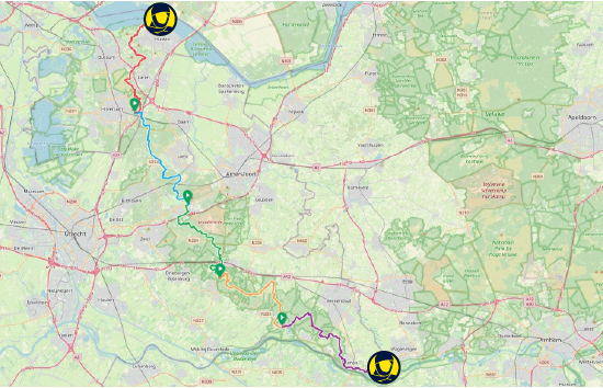
The Heuvelrughike begins at the Gooimeer and leads in 5 stages through quiet farmland, forests, and heathlands. It’s the only continuous route along the full length of the Heuvelrug — an expansive 20,000-hectare area of forest and heath. The route includes the highest ‘mountain’ in the province of Utrecht: the Amerongse Berg, standing at 69.2 meters — also the highest point of the hike.
One big advantage of this hike is that each stage is accessible by public transport, making it easy to hike a single stage instead of the whole trail. The Heuvelrughike is not signposted, but it can be navigated using a hiking guide or app. At the end of each stage, there are various overnight stay options.
Length: 92 km
Days: 5
Start: Huizen
End: Rhenen
Tip: For optimal temperature regulation, high-quality wool clothing is essential. Wool keeps you warm in the cold and cool in the heat. Check out our merino wool collection.
IJmondpad - 77 km
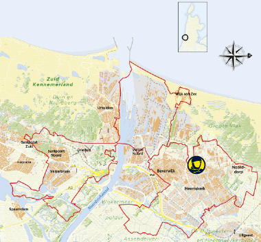
The IJmondpad combines the diverse landscapes of Heemskerk, Beverwijk, and Velsen into a 3-day hike. The circular route leads through scenic nature reserves and open fields, as well as along historic defense lines that are part of the UNESCO World Heritage.
The route includes Fort Veldhuis, one of the oldest concrete forts of the Defense Line of Amsterdam — a highlight for history lovers and students. In summer, the final stage begins with a water taxi ride across the North Sea Canal from IJmuiden to Wijk aan Zee.
Length: 77 km
Days: 3
Start/End: Heemskerk (Geversduin)
Tip: The Netherlands can be rainy, but don’t let that stop you from exploring nature. Be sure to bring a good rain jacket — and you're ready to go!
Veluwe Zwerfpad Stage 1 - 56.6 km
The full Veluwe Zwerfpad is 374 km long and absolutely worth it if you're looking for a longer challenge. Here, we focus on the first stage: from Arnhem to Lunteren. The distance is perfect for a weekend trip, as you can easily split the 56 km into 2 or 3 stages.
The Veluwe is a protected nature reserve and home to wildlife such as red deer, foxes, and wild boars. The full route leads through vast areas of drifting sand, expansive heathlands, and gently rolling hills. Even just the first stage offers varied landscapes. The trail runs from Arnhem’s beautiful city park to the heathlands of Wolfheze, and is easy to follow via yellow/red markers.
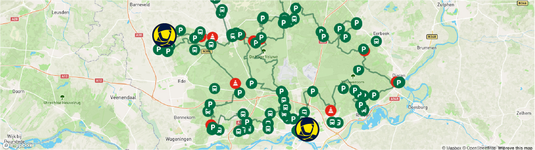
Length: 56.6 km
Days: 2–3
Start: Arnhem Central Station
End: Lunteren
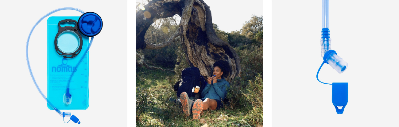
Tip: When preparing for long hikes, snacks and water are key. A hydration bladder is one of the easiest ways to stay hydrated and a must on the trail.
Going for a hike? Share your adventures with us online: #IAMNOMAD